
Properties T22 MD, Maine
Lot 121 Upper Lead Mountain Pond Rd
T22 MD, ME 04408
$209,000
2 bed · 528 sqft · 1.64 acres
35 photos · tap any to browse
The property
A furnished 528-square-foot off-grid camp from 1970 on 1.64 acres in T22 MD, an unorganized township in Hancock County, Maine, with solar, a generator, hauled water, a bathhouse with a shower and no bathroom in the camp, 800 feet of shared frontage on Upper Lead Mountain Pond a walk away, a dirt association road, and a state tax bill of $380

This is a furnished off-grid camp of 528 square feet built in 1970 on 1.64 acres on Upper Lead Mountain Pond Road in T22 MD, an unorganized township in Hancock County, Maine, off the Airline between Bangor and Calais. The remarks describe a renovated camp with two bedrooms, an open kitchen and living area, an enclosed porch, a wood stove and a propane heater, solar power with a backup generator, a bathhouse with a shower and a sink, a rainwater collection system and a propane on-demand water heater, a new 14 by 12 shed with two lean-tos, and a short walk to shared waterfront on the pond with an aluminum dock included. The listing gives no baths, water as none, sewer as other, and 800 feet of shared frontage. It was listed on July 27, 2026 at $229,000 and cut to $209,000 on September 17.
There is no street number and no town. The listing carries the camp as Lot 121, which is its number on the state’s plan of the Upper Lead Mountain Pond Camp Lot Subdivision. Aurora is the post office. T22 MD, Township 22 of the Middle Division, has no town government: the state assesses and collects the property tax, the Land Use Planning Commission is the planning board and the code office, and Hancock County provides what services there are.
The camp
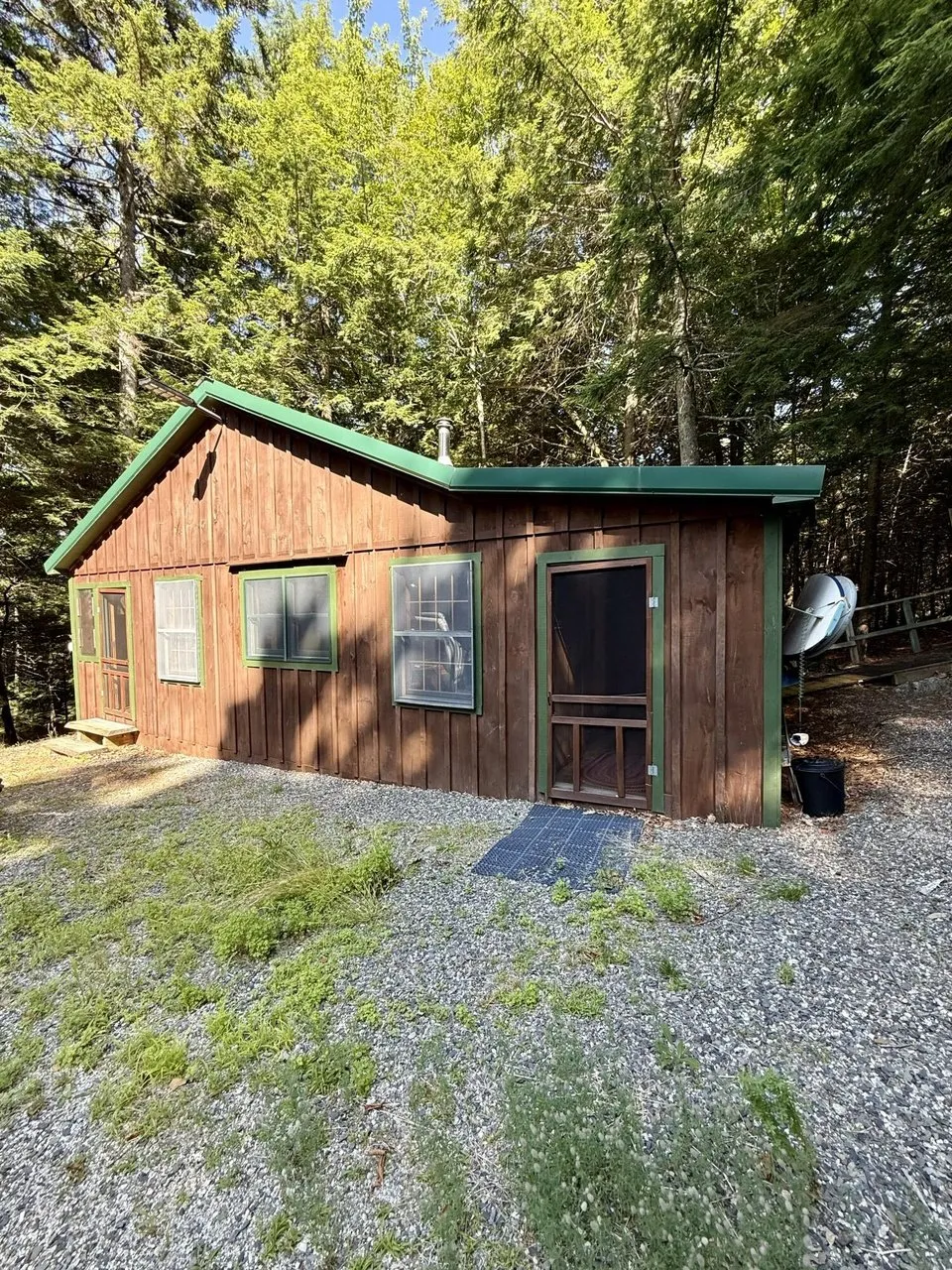
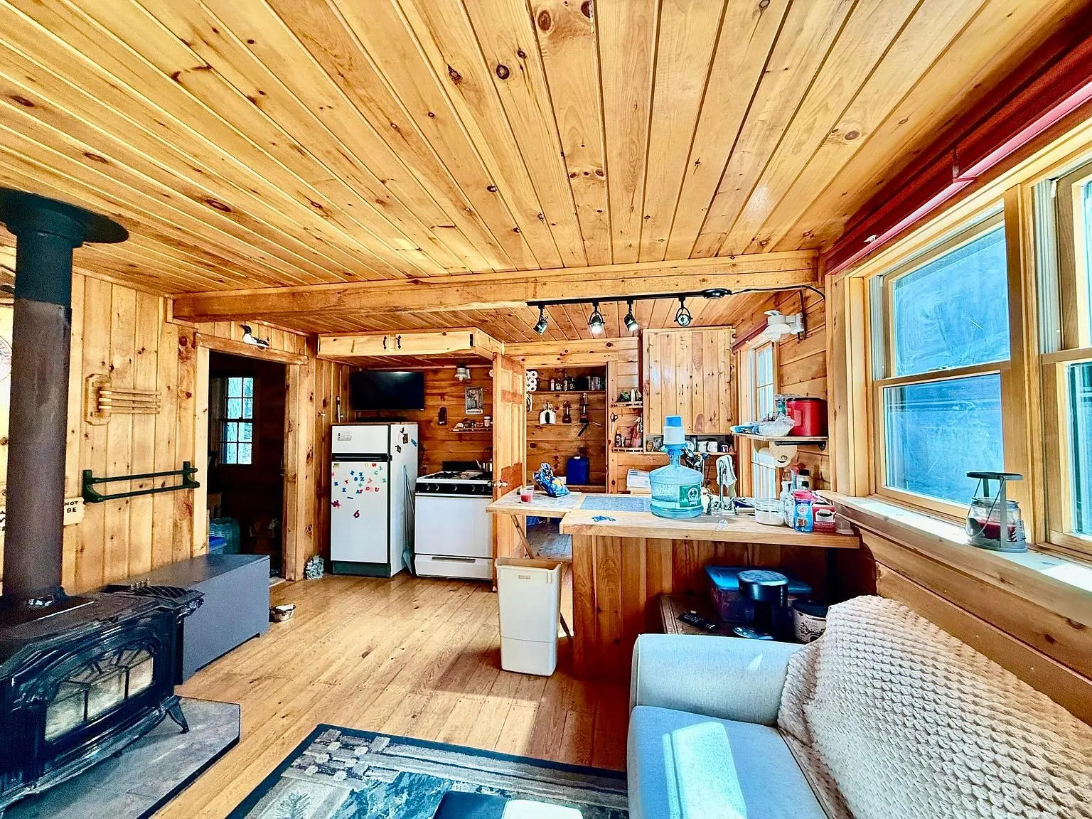
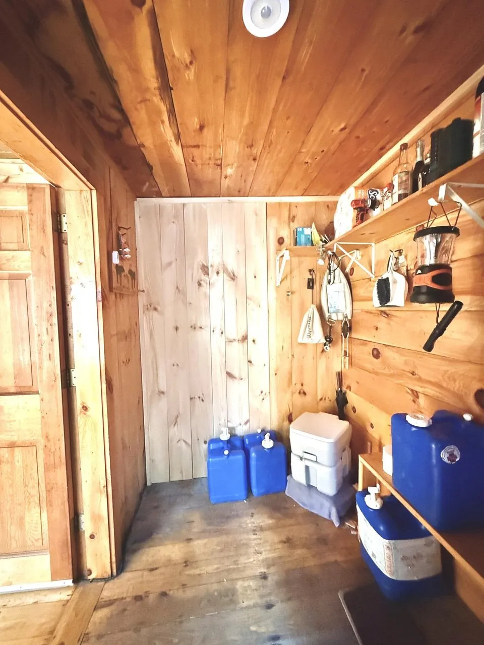
The photos show a low wood-sided camp with a green metal roof, a row of porch windows across the front, a screen door, a solar panel on the ground by the step and a satellite dish at the corner, on a gravel yard under spruce. Inside, every wall and ceiling is pine. The enclosed porch runs the length of the front with a stool and a braided rug. The main room has a wood stove on a hearth, a sofa, a table, a sliding barn door, and a kitchen with a gas range, a refrigerator and track lights. One bedroom has a bed and a quilt, and a second has bunks with a ladder. The entry holds blue water jugs, a portable toilet and lanterns on a shelf.
The outbuildings and the power
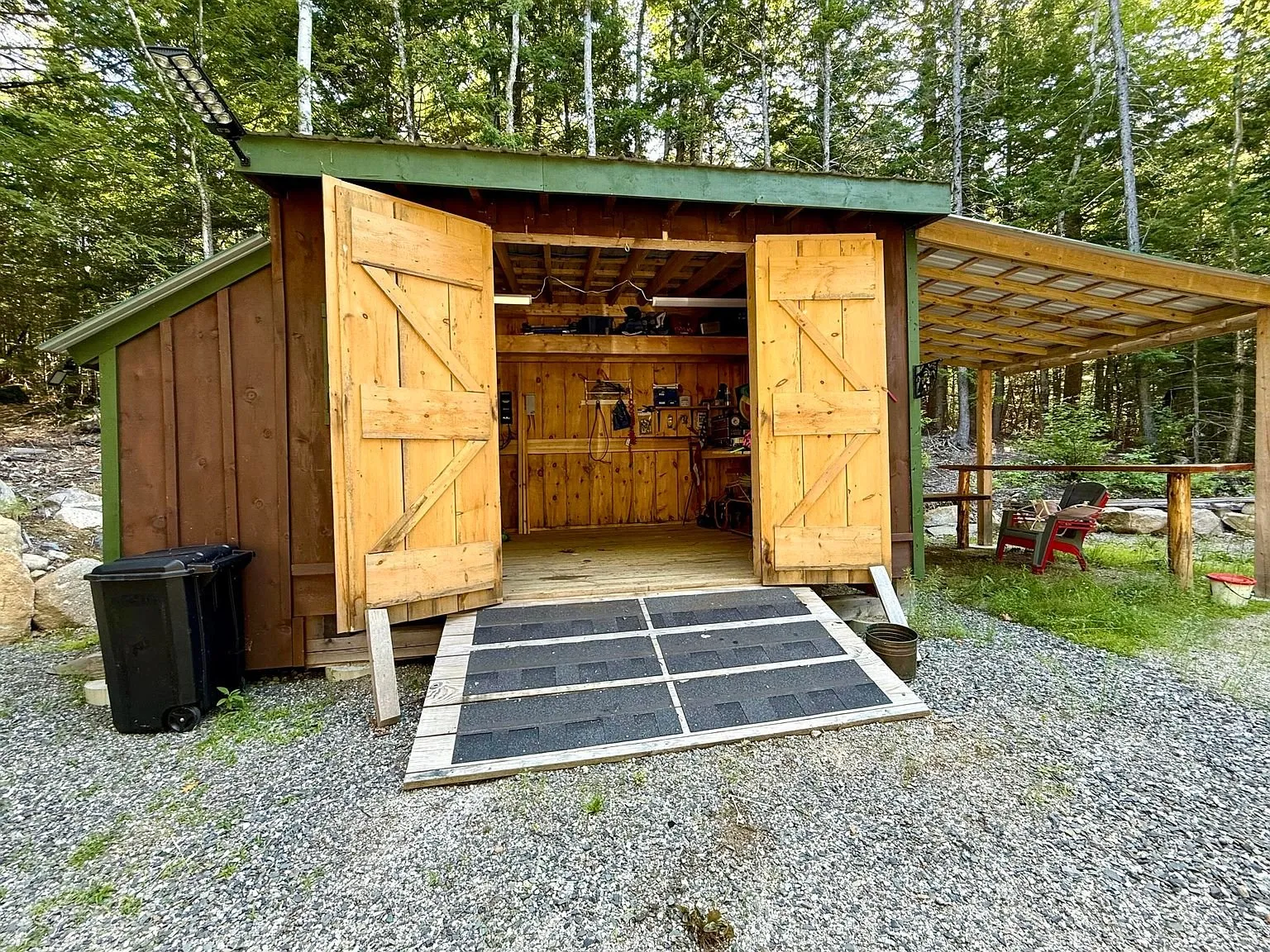
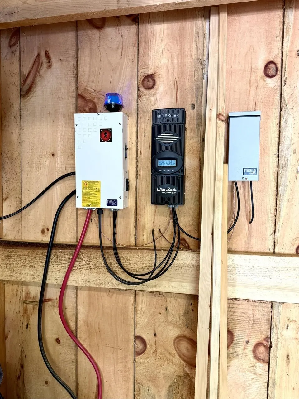
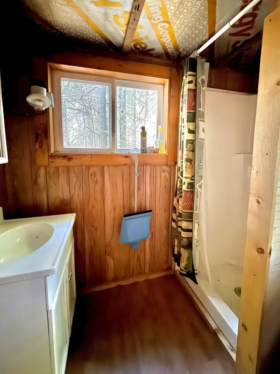
The new shed stands with its doors open, a ramp in front and a lean-to on each side, one of them fitted as an outdoor bar. Inside, a charge controller, an inverter and a breaker panel hang on the wall, and a generator sits on the floor with a gas can. Two propane cylinders stand in the yard. The bathhouse has a sink in a vanity, a window and a shower stall, under a ceiling of printed sheathing.
The pond
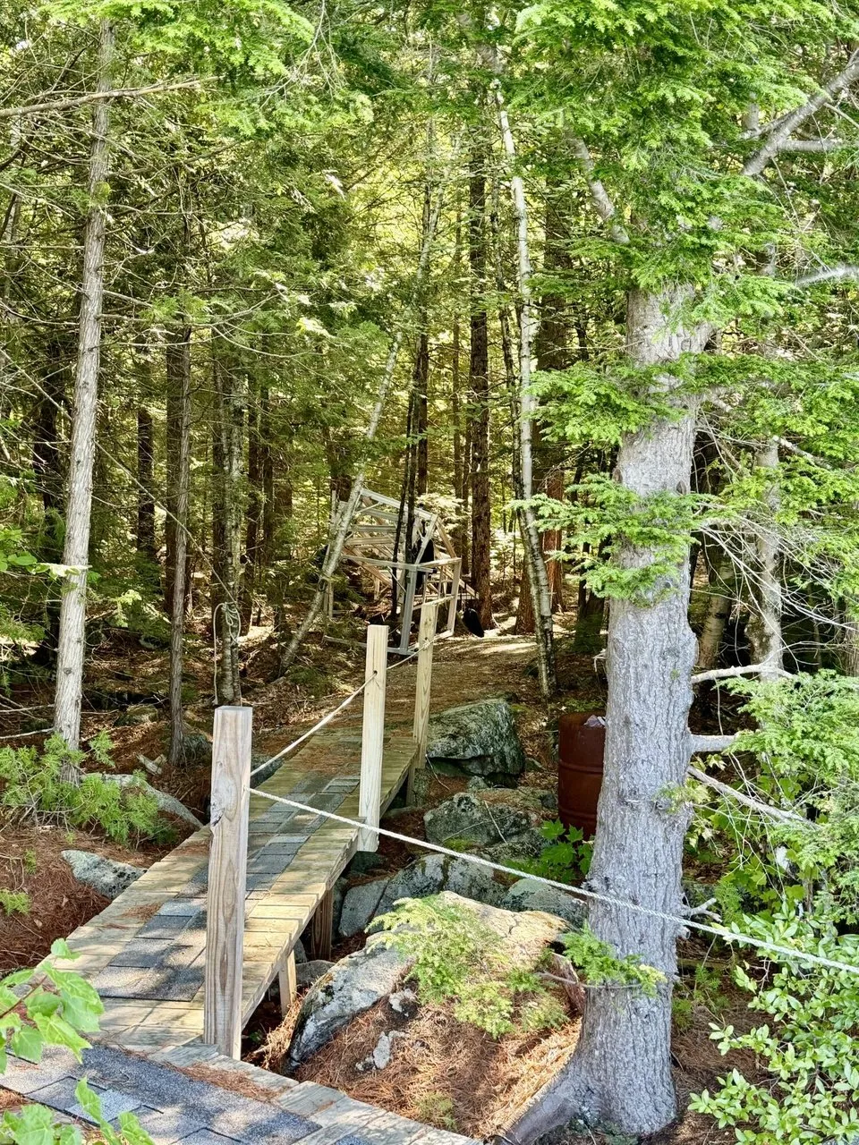
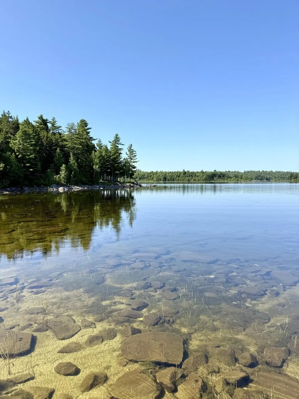
A boardwalk with a rope rail runs through the woods, and a path goes down to the water. The photos show Upper Lead Mountain Pond clear over a stony bottom and the far shore in spruce, and the sections of an aluminum dock stored in the trees. The national hydrography data puts the pond, about 980 acres, between 50 and 100 meters from the listing’s coordinates. The state’s boat launch on the pond, held by the Bureau of Parks and Lands, is within 300 meters.
The facts
| Price | $209,000 |
| Acreage | 1.64 acres per the listing. State valuation book: 1.64 acres, Map HA008 Plan 02 Lot 121. The state’s parcel map computes 2.2 acres for the same lot |
| Township and county | T22 MD, Township 22 Middle Division, in the East Hancock unorganized territory, Hancock County, per the coordinates and the state record. Aurora is the post office |
| Beds / baths / sqft | 2 beds, baths Not listed, 528 sq ft per the listing |
| Year built | 1970 |
| Property type | Single family residence, camp, per the listing |
| Property taxes | $349 per the listing. State valuation book: $380.36 for 2026 |
| Assessed value | Not listed. State valuation book for 2026: land $32,600, building $68,290, taxable $100,890, no exemptions |
| HOA | Yes, $250 a year per the listing |
| Financing | Not listed |
| Water | None per the listing. Rainwater collection per the remarks. Water jugs in the photos |
| Sewer | Other per the listing. Bathhouse and outhouse per the remarks. Outhouse or privy per the structures field |
| Power | Off grid, photovoltaics, seller owned. Generator |
| Gas | Propane heater and propane on-demand water heater per the remarks. Gas range |
| Internet | Not listed. A satellite dish in the photos |
| Heating / cooling | Wood stove and other. Cooling none |
| Furnished | Yes |
| Construction | Wood frame, wood siding, post and pier foundation, metal roof. No basement. Wood floors |
| Structures | Outhouse or privy and sheds per the listing. A 14 by 12 shed with two lean-tos and a bathhouse per the remarks |
| Water frontage | 800 feet shared on Upper Lead Mountain Pond per the listing. None on the lot |
| Road access | Upper Lead Mountain Pond Road, dirt, an association road per the brokerage’s listing. Plowing Not listed |
| Zoning | Residential per the listing. D-RS, Residential Development Subdistrict, per the Land Use Planning Commission’s zoning layer |
| Flood zone | FEMA Zone X, minimal flood hazard, at the coordinates and within 500 meters per the National Flood Hazard Layer |
| Days on market | 52 on Zillow. Date on market 7/27/2026 |
| Listing history | Listed 7/27/2026 at $229,000. Cut 9/17/2026 to $209,000. No prior sale on either site |
| Listing agent | Heather Knapp, 207-557-7371. Co-listed with Mary Knapp, 207-598-8188 |
| Brokerage | Realty of Maine, Ellsworth, 207-667-2300. Zillow and Redfin print the brokerage name alone, so the agents and numbers come from Realty of Maine’s own page for this listing |
| Agent email | Not listed |
| MLS | Maine Listings #1673685 |
What to know before you call
An unorganized township, and what that changes. T22 MD has no selectmen, no town office, no town road crew and no local code officer. Maine Revenue Services assesses the property and sends the bill. The Land Use Planning Commission zones the land, issues building permits and enforces them from a regional office. The county sheriff and the state police are the law, fire protection is whatever the county contracts, and a school-age child is the state’s responsibility to place. None of that is a problem for a camp. All of it matters if you mean to live here.
The tax is the lowest thing about it. The state’s 2026 valuation book values the lot at $32,600 and the camp at $68,290, taxes the $100,890 at the Hancock County unorganized territory rate of 3.77 mills, and bills $380.36. The listing prints $349, which is an earlier year. No exemptions are on the account, so a homestead exemption is not deflating the figure, and a buyer who makes this a primary residence could apply for one. The state revalues on its own schedule, and a $209,000 sale against a $100,890 valuation is the evidence it uses.
Shared frontage is not frontage. The listing gives 800 feet of waterfrontage and 800 feet of shared waterfrontage, and the remarks say a short walk to the shared waterfront. The lot is not on the water. The state’s plan shows Lot 121 among the back lots of the Upper Lead Mountain Pond Camp Lot Subdivision, with the pond 50 to 100 meters from the listing’s coordinates. Ask what the deed says about the shore: a deeded right in common to a named shore lot, a membership in the association that owns it, or a license. Ask who else shares the 800 feet, where the included dock is allowed to go, and whether the association can change the rules. The $250 a year is the association’s, so ask for its bylaws and budget.
A dirt association road off the Airline. The listing gives the road surface as dirt, and the brokerage’s page calls the frontage association. Camp roads in this country run over land that was paper company land, and many still cross it. Ask whether the right of way from Route 9 to the lot is deeded and recorded, who owns the ground under it, whether there is a gate or a fee, and who grades it. Ask whether anyone plows it. A camp on post and pier with a wood stove and hauled water is a three-season camp unless the road says otherwise, and at this latitude winter runs from November to April.
No water, no septic, and a shower. The listing says water none and sewer other. The remarks describe rainwater collection, a propane on-demand water heater, and a bathhouse and outhouse with a shower and a sink. The photos show blue water jugs and a portable toilet in the entry, and a vanity and a shower stall in the bathhouse. Ask where the shower and the sink drain. In the unorganized territory the Land Use Planning Commission and the state plumbing code govern a privy and a gray water system, and both need permits. Ask for them. A lender will want a bathroom count the listing does not give.
Inside the state’s shoreland rules. With no town there is no town shoreland ordinance. The Land Use Planning Commission’s zoning layer puts the lot in a D-RS residential development subdistrict with a general management subdistrict beside it, and the commission’s standards apply its own shoreline setbacks, clearing limits and lot standards within 250 feet of a great pond. Ask the commission’s Downeast office which structures on this lot have permits on file: the camp, the enclosed porch, the new shed and its lean-tos, the bathhouse, the boardwalk, and the dock.
Not in Tree Growth, and no conservation easement on it. At 1.64 acres the lot is far under the ten forested acres Tree Growth requires, and the state values its land at a full $32,600. The state’s conserved lands layers show no easement on or beside the lot, state or private. The only conserved land within 600 meters is the state’s boat launch. The timberland around the subdivision is a different matter: ask who owns it, because their harvest schedule is your view and their gates are your neighbors.
Owned, not leased. Some camps in this township stand on leased ground: the state’s valuation book lists buildings on Ursa Major lease lots with no land value at all. Lot 121 carries a land value and an acreage, so the lot is owned with the camp. Confirm it in the deed all the same, and confirm the 1.64 acres, because the state’s own parcel map draws the lot at 2.2.
Solar, a generator, and what they run. The listing says the photovoltaic system is seller owned, and the photos show a charge controller, an inverter, a breaker panel, one panel on the ground by the step and a generator in the shed. Nothing gives the array’s size, the battery bank’s age or what the system carries. Ask for the specifications and whether the refrigerator in the photos runs on it or on propane.
Furnished, and what that includes. The listing says furnished and the remarks say fully furnished, with the dock included. Ask for a written list, and ask whether the generator, the propane cylinders and the canoe-shaped bar in the lean-to are on it.
Thirty-five photos of 47. Zillow and Redfin carry the same 47 in the same order. We used 35, taking the sharper file of each from whichever site had it, with the listing’s first photo as the cover, and left out near-duplicate views of the camp, the rooms and the pond. There is no photo of the road, the outhouse, the rainwater system, the shared shore lot or the dock in the water. Nothing is virtually staged.
You can see everything else we have listed on the properties page. This is our second Maine property, after a log cabin on a town road in Bradford. For another off-grid camp with hauled water we have an A-frame above a pond near Brook Park, Minnesota.
To ask about this one, call Heather Knapp at Realty of Maine on 207-557-7371, or Mary Knapp on 207-598-8188, or the Ellsworth office on 207-667-2300, and reference MLS 1673685. Tell them where you saw it.
$209,000 · 2 bed · 528 sqft · 1.64 acres
The email
Get properties like this by email.
Hand-picked affordable homes, land, and acreage, each one turned into video, in your inbox first.